Understaing BIM & Level of Development (LOD)
Building Information Modeling (BIM) is often employed by AEC professionals to develop and maintain digital representations of a facility’s physical and functional characteristics. The level of development captured in the model can range from generic graphical placeholders for key components (LOD 100) to fabrication-ready details (LOD 400). Castaway Building Measurements develops 3D Revit models to support BIM at the LOD 300 level based on the industry-standard Level of Development (LOD) Specification maintained by BIMForum.
Our Technology: The Foundation of Accuracy
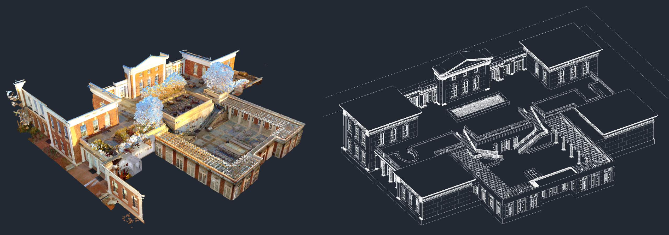
Precision starts in the field. We use the industry’s most advanced LiDAR measurement technology to capture millions of data points per second. Most scans are performed with a NavVis MLX or Leica BLK2GO portable LiDAR scanner, both of which pair survey-grade LiDAR sensors with SLAM (Simultaneous Localization and Mapping) to rapidly and accurately measure all aspects of a property from large-scale structural elements to fine-scale intricate details. This high-density point cloud data ensures that whether you need a simple floor plan or complex BIM, the underlying geometry is accurately documented.
Defining Level of Development
Castaway Building Measurements offers Revit modeling services at LOD 300, which is defined as a 3D model that accurately details the size, shape, location, orientation, and quantity of model elements.
LOD 300: Accurate Architectural As-Built Model
These models provide an accurate representation of the architectural elements like walls, doors, windows, columns, and beams as captured by our LiDAR scanners.
Best For: Architects, Engineers, and General Contractors
Goal: To provide a reliable “Base File” for renovation, structural analysis, and MEP coordination.
The Result: A detailed 3D Revit model to integrate directly with your BIM workflow.
The Castaway Advantage
LiDAR-Backed BIM: Unlike firms that rely on manual single-point measurements, our models are built directly on top of LiDAR point clouds, significantly reducing the margin of error.
Seamless Integration: Our models are delivered in native Revit (.RVT) or SketchUp (.SKP) format, ready to by integrated into your existing workflow the moment you receive them.
DMV Expertise: Based in Fairfax, VA, we understand the diverse commercial and residential landscape of the DC, Maryland, and Virginia region.
Ready to Start Your Next Project?
Reach out to us at info@castawaymeasurements.com. We are happy to discuss the details of your project and provide a proposal based on your needs.